
Emsworth History
Emsworth has always been a thriving, bustling diverse community, and therefore it is difficult to produce a set of chronological history. Therefore different themes have been used to give an overall impression of the town.
*- indicates that the building is still standing
Early History
Stone Age – Some early scrapers and flint tools have been found between Conigar Point and Nore Rithe (Maisemore Gardens area)
Roman – There was no Roman occupation in Emsworth, although there was a causeway across the River Ems. There was a small villa south of the A259 at Warblington, on the Chichester to Portchester road.
Saxon – Domestic finds have been found during construction of Seafields and Beacon Square in the 1960s. They are early 11th century and seem to indicate a summer camp rather than a permanent settlement.
Late Saxon – The Warblington and Westbourne areas belonged to the manor of Bosham just before the Norman Conquest. This manor was one of the main manors of the Earls of Wessex, and the Earl at the time of the Conquest was King Harold (arrow in the eye at Hastings!)
Medieval – Emilsworth was given first charter in about 1216 by King John and this was renewed at various intervals. The charter giving the market rights was given in 1239
Tudor – Warblington Castle was rebuilt by Margaret Pole, who was cousin to Henry VIII and was governess to Princess Mary (Bloody Mary). She and her sons refused to renounced the Roman Catholic Church and Henry had her executed and her sons exiled. It is said that Margaret refused to kneel at the traitors block and the executioner had to chase her around the block taking swipes as he could. It took 7 swings to sever her head. Her sons supported Mary when she became Queen and one of them (Cardinal Reginald Pole) was appointed Archbishop of Canterbury. The castle was dismantled during the English Civil War.
Local Government
The present Museum is located in the building which was originally built as the Warblington Urban District Council offices (1900 – 1932)*
In 1932 local government was reorganised and Emsworth was absorbed into Havant & Waterloo UDC.
Finally in 1974 Havant Borough Council was formed and is still the local authority.
April 2019 Emsworth Neighbourhood Plan 2019-2036 submitted to Havant Borough Council.
8 July 2021 Referendum on the Neighbourhood Plan held in Emsworth.
91% voted in favour.
22 September 2021 Emsworth Neighbourhood Plan 2019-2036 adopted by Havant Borough Council. It will be used in the determination of future planning applications.
Public Buildings
St. Peter’s Chapel * – Was originally built as a Proprietary Chapel so people did not have to go to Warblington Church every Sunday. It could only take the general services, so weddings, funerals and baptisms still took place at Warblington. People could rent or buy their pew, and only those who did this could use the chapel. The poor still had to go to Warblington.
Old Town Hall *– When St. Peter’s Chapel closed it was used as the Town Hall until the official one was built in 1900. The Museum is in the official Town Hall which was used until 1932.
Cinema* – The old town hall building in the Square was used as a cinema during the middle of the 20th century, either side of the 2ndWorld War. This building is now the Greenhouse Café.
Town Hall and Fire Station in North Street.* This was built for the Warblington Urban District Council and was in use until 1932. The fire station has been in constant use since then, and is one of the oldest fire stations still in use in England. The upper floors were converted into a flat during 2nd World War. After the war it was a public hall with parties and dances held regularly, including various clubs such as the Women’s Institute. It is now the Museum
Post Office was originally in The Square from about 1866. Then in various buildings in the High Street. The main Post Office* in North Street was built in 1903 and is still in use as the sorting office. The main counter service is supplied by the Co-op in High Street.
Hospital originally established as the Jubilee Hospital in King Street to mark the Golden Jubilee of Queen Victoria. In 1897 a new building was proposed to mark the Diamond Jubilee and was named Victoria Cottage Hospital* and established in North Street. It closed in 2006.
Northlands was a private house in Horndean Road that was then used as a military hospital during the 1st World War assisting Belgian refugees, and then as a maternity hospital. It was demolished to make way for the A27. It was just to the north of the railway bridge, on the right hand side of the road.
Churches and Chapels
St. Thomas a Becket, Warblington * is the mother church. In Tudor times it was the Church of Our Lady. Dates from early 13th century with parts of the tower considered to be Saxon. All religious services were held there and people of Emsworth walked across the fields. Still in use as parish church, with churchyard closed in 1895. Warblington Cemetery dates from this time and is run by Havant Borough Council.
St, Peter’s Chapel * was built in Emsworth Square in 1789 and was a Proprietary Chapel. Those who could afford to buy or rent their pew did not have to go across the fields to Warblington, but the poor could not use it. It closed in 1850 when St. James was enlarged and has had a chequered life since then.
St. James Church * has main entrance from Church Path, which used to be Church Road, and also an entrance from North Street. Built in 1842 and altered considerably to accommodate more people. Still in use as the parish church, with the old church school, parish hall and rector’s house all forming a collective pattern.
Independent Chapel built in Nile Street in 1808 and then moved to corner of Bath Road in 1860s. The original Chapel* is now a private industrial unit, while the Bath Road building * is used as a meeting place, and the United Reformed church has amalgamated with the Havant church in Elm Lane in Havant.
Baptist Church * was built in North Street in 1848, and was known as the Zion Chapel. Has been rebuilt and the church hall was built as a wedding gift from Mr. Jones when he married the lady organist of the church. There are big plans for rebuilding again to make a large community meeting place as well as the church.
Primitive Methodist Chapel * built on The Square in 1876. In 1970s was remodelled to provide a community space as well as chapel, and became the Pastoral Centre. Recently took over Marloes House on corner of Nile Street and using it as an extension for meeting rooms etc. This part is now called International House, because International Stores used to have a shop there.
Education
In North Street the Overseers of the Poor at the Poor House (1812 – 1839).* This building is now three cottages north of the entrance to the Church.
1839 – 1842 a small establishment in Bridge Road.
1842 – 1909 the school house in Bridgefoot Bath (on corner of School Lane)*
1865 – 1974 The Church School in Church Path (now the community centre)*
1909 – 1994 Washington Road Council school – originally for 5 – 14 yrs, then in 1955 Warblington Secondary School took the top classes and the school catered for 5 – 11 years.
1972 to date Emsworth Primary School, near the top of Victoria Road, was built for 8 – 12 years, while Washington Road took the 5 – 8 years.
to date - The two school combined into a through Primary School and Washington Road school closed to mainstream education.
1974 to date – The Church School* moved to a new site in Bellevue Lane. They suffered a traumatic fire in 1979 and whole school rebuilt.
1998 to date – Washington Road School* is now Glenwood School for secondary pupils with special needs.
Trade & Business
Brewing & malting
Emsworth Brewery (run by Kinnell & Hartley) in South Street and Bridgefoot Path. Closed in 1928
Dolphin Brewery behind The Dolphin in Queen Street, but accessed from King Street. (19th century venture)
Saffron Brewery in Hermitage
The Sussex Brewery * in Hermitage (now Sussex Brewery Pub) in late 19th and 20th century.
Brick-making
Sites in Bath Road, Hermitage and New Brighton Road.
Map on brickmaking display in main room.
Gas Company
Company office was in solicitors in Queen Street. (Arnold Cooper & Tompkins)
Gasholder erected in Obscure Road, now Palmers Road. Site first used in 1854.
Pipe making (tobacco clay pipes)
Taplin family during 18th & 19th centuries in premises on Mud Island, which is area behind Lilleywhite’s garage
Sack Making
Tatchell’s premises near bottom of King Street (near Stanley Road). Mr. Tatchell only had daughters, one of whom married Mr. Lewis and it was renamed Lewis’s.
Now in The Wren Centre in Westbourne.
Soap making
Hendy’s Quay which is at bottom of King Street.
Timber yards
Various yards along King Street owned by Smith, Tollervey, Miller & Tier.
William Foster had timber yard and saw mill behind house in King Street.
J.D. Foster stored timber in the Big Bunny (now the Marina) in the water of the harbour and in Bridge Road (where car park now is).
Maritime Trade
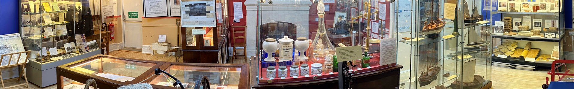
Oyster dredging (fishing) was the main industry in the harbour for many years. First mentioned in 1307. Lots of ups and downs over the centuries with the industry being completely overhauled in the late 19th century by James Duncan Foster and Jack Kennett. In 1902 typhoid infected the crop and caused illness in various towns. The industry was banned and never recovered. Still some fishing done in October and November. (Separate area in Museum devoted to the trade)
Smuggling – there were rumours of a network of tunnels, but it is more likely to have been routes through connecting cellars. The Old Pharmacy was meant to be the main storage, with a secret room. Smuggled goods came in with the fish. It has taken place since the 14th century.
Shipbuilding started in the 14th century in Bridgefoot Path, but when the mill pond was created the industry moved to King Street (orSweare Lane as it was known). John King and his family built up a business in King Street (which was named after him) and this passed to David Palmer, Mr. Walker and then William Foster. J.D. Foster developed his own shipyard to support his fishing fleet at the bottom of King Street on old Hendy’s Quay. Other names are John Day, Smyth and Apps. Now only Dolphin Shipyard in Queen Street.
Rope making to support the sailing industry was important. Three rope walks in the area. Tatchell had his rope works in King Street and there were three rope walks in Emsworth. One in North Street, one between Thorney Road and Gordon Road running parallel to the main road (which is why their front gardens are so long) and one at right angles to the main road at Hermitage, running down beside the Sussex Brewery to Round House Meadow.
Sailmaking – Most of the business was in King Street, with Tatchell’s yard near Stanley Road. Tatchell had three daughters, one of whom married Mr. Lewis and it became Lewis’s before 2nd World War. There was also a sailmaker’s yard in Hermitage during 19th century. Other sailmaking names are Miller and Crockford.
Mills
Town Mill * was the original community mill, where everyone had to take their grain for grinding. This was water powered on the River Ems and at the bottom of Mill Lane. This road is now Queen Street and the mill has been turned into an industrial unit. Water power lessened and a turbine was installed. This is still in place in the stream beneath the mill. The mill burnt down in 1896 and was rebuilt as it is now seen.
Quay Mill *, at bottom of South Street, was built in middle of 19th century and the mill pond (the largest in England at 10 acres) was constructed by damming the West Brook. It could load grain directly into the ships with the deep water channel beside it, and this made it easier than for some of the other mills which had to carry the cargo out in small lighters to the larger ships. It ceased milling in middle of 20th century and was a warehouse until sold to Emsworth Slipper Sailing Club in 1970s, when it was completely refurbished.
Lumley Mill *was on land belonging to the Lord of the Manor of Westbourne and was an important mill in the area. Supplied goods to the Navy at Portsmouth, including ships biscuits. Records date from 17th century, but it burnt down and only the millers’ house survives. Fed by mill race leading off River Ems in Westbourne.
Slipper Mill* was built and fed by damming the mill race of the Lumley Pond. The pond could also be filled by the incoming tide. Ceased working at beginning of 2nd World War and pulled down. Storage area converted to housing.
2nd Slipper Mill was constructed at entrance to Big Bunny (now the Emsworth Marina) opposite the outfall of the Slipper Mill Pond. It failed because the tide from the Slipper held up the flow from the mill-pond and no power could be generated. Burnt down.
Various saw mills along King Street fed the ship building yards.
A mill is mentioned in Doomsday of 1086, but no other records of it.
Inns & Public Houses
The Anchor* was at the bottom of South Street. It was used as a customs house at one time. Closed before 2nd World War. Was used for some years as clubhouse for the Slipper Sailing Club and is now 36 on The Quay Restaurant.
The Black Dog* on corner of High Street and The Square. Was used for various public events, such as inquests and auctions. Became The Smugglers and then The Round Table before becoming a wine bar called Allwoods and then an Indian restaurant called Spice Village.
The Blue Bell in South Street was near the site of the South Street Centre, but was rebuilt in its present position in the 1960s
The Coal Exchange* in South Street was originally built on the site of the building where ships’ captains came to be paid for the coal they had just delivered and negotiate for cargoes to take back.
The Crown* in High Street. The earliest known in Emsworth. Was a coaching inn and is recorded in 17th century. Used for official dinners and dances.
The Dolphin* was built as a hotel with brewery behind during the 19th century. It is now private flats.
The Great Eastern* was in Hermitage and is now a private house with grounds sticking out into Slipper Millpond on the corner of Slipper Road
The Fairfield* was at the top of New Brighton Road and is now the Children’s Learning Centre and Nursery.
The King’s Arms* in Havant Road was the base for the Emsworth Bowling Club in late 19th century and early 20th century.
The Little Green was run by the Dorey family at beginning of 20th century. Eventually became The Swap Shop and was demolished when Tescos was built
The Locomotive was in North Street and was demolished in the 1960s for The Seagull which was demolished and flats erected on the site.
The Lord Raglan* is at bottom of Queen Street and named after the commander of the Army in the Crimean War. It is at risk of flooding on high tides and is the only pub in Emsworth with a garden overlooking the water.
The Railway Inn* was originally the Railway Commercial and Family Hotel built to serve the new railway.
The Royal Oak* was opposite the Great Eastern and is now a B&B
The Sawyer’s Arms was in Havant Road.
The Ship* in High Street. Was first recorded in the 18th century
The Sloop in South Street was 19th century
Sussex Brewery* was also Saffron Brewery at the top of the hill at Hermitage and is still a pub.
The Town Brewery* was a fairly late addition and is in West Street.
The Wheelwright’s Arms was in North Street
The White Swan was in The Square, near the entrance to South Street and had stabling for horses. (19th century)
Transport
Railway – The London, Brighton & South Coast railway built a station in 1847.
Canal – The Portsmouth to Arundel canal from Milton Lock in Portsmouth went across the harbour and north of Thorney Island. It was built in 1823 but was not a success and ceased trading in 1838.
Roads – The A27 Chichester to Portsmouth Road ran through the middle of the town. In 1935 it was proposed that the town centre be by-passed. In the 1970s the short bypass was constructed from the Hermitage through to the Mill Pond behind the shops in the Square and cut the town in two. In 1980s the original proposal to build a bypass right around the town was acted on, and the dual carriageway runs parallel to the railway, with no access from Emsworth.
Famous Residents
Sir Peter Blake – New Zealander who won the America’s Cup for New Zealand and many other awards. He made his home in Emsworth, married locally and when he was killed by Brazilian pirates he was buried at Warblington.
General Sir Brian Horrocks – Commanded the 8th Army during the desert campaign of the 2nd World War and settled in Emsworth later. He later became an author of military books
Sir Richard Thomas was Black Rod in parliament. His uniform is held by the Museum.
P.G. Wodehouse moved to Emsworth in 1904, living at Emsworth House School to begin with and then moving into Threepwood in Record Road. He went to America on holiday in 1914, but was caught by the beginning of the 1st World War and settled there. He returned to Emsworth occasionally until 1929. Emsworth is the place where he lived longest in England and the Museum is the only public museum with memorabilia on display. (Separate section in the Museum for P.G. Wodehouse).
Local Names
There are many local names associated with Emsworth.
As we build up our archives we will create family histories which will be recorded on the computer so that they can be added to when new information becomes available.
A display of the Prior family is in the main hall.
Barter also has a family tree on display.
Newell is on the computer